GPS / GNSS Navigator
A GNSS navigator is the ship's primary electronic position source, feeding a continuous fix to ECDIS, AIS and the autopilot rather than answering a single question the way an echo sounder or speed log does. SOLAS treats it as core bridge equipment, not an accessory.
Read more — GPS / GNSS Navigator explained ▾
What sets a GNSS navigator apart
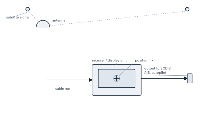
Where the echo sounder reports depth under the keel and the speed log reports motion through the water, the GNSS receiver reports where the ship actually is, continuously and independently of local water conditions. It is the electronic position fixing system SOLAS requires as standard bridge equipment, and its output feeds almost every other navigation and safety system aboard: ECDIS chart position, AIS transmitted position, autopilot course reference, VDR recording, and often the ship's own timekeeping through the GNSS time signal.
Main components
Antenna
Mounted with a clear view of sky, free of obstruction from masts, funnels or radar scanners that could cause signal shadowing or multipath reflection.
Receiver unit
Processes signals from one or more satellite constellations (GPS, GLONASS, Galileo, BeiDou) simultaneously, computing position, course over ground and speed over ground from the combined solution.
Augmentation and correction
Differential correction via satellite-based augmentation systems (SBAS) or, in some regions, ground-based DGPS improves accuracy beyond standalone GNSS, useful for close-quarters manoeuvring and pilotage.
Interfaces
Output over NMEA 0183 or NMEA 2000 to ECDIS, AIS, radar, VDR and autopilot; loss of this interface, not just loss of satellite lock, is a common cause of position failure elsewhere on the bridge.
Selection and sizing
Multi-constellation reception improves availability and resilience, particularly in areas with known interference. Update rate (commonly one update per second) and the number of channels affect how quickly the receiver reacquires after a signal loss. SOLAS vessels are required to carry a means of determining position that does not depend on a single system, which in practice means two independent GNSS receivers or a second independent method, since GNSS as a technology is a single point of failure if only one unit is fitted.
Regulations and class requirements
SOLAS Chapter V regulation 19 sets the carriage requirement for an electronic position fixing system on vessels of the relevant size and trade. Equipment must carry wheelmark type approval confirming it meets the IMO performance standard for shipborne GNSS receivers. Periodic checks against known reference positions and interface verification during survey confirm the system remains within tolerance.
Typical faults
- Antenna cable degradation from UV and weathering, causing intermittent signal loss that is hard to diagnose from the bridge alone.
- Jamming or spoofing in certain sea areas, producing a plausible but incorrect position that downstream systems accept without warning.
- Signal shadowing from superstructure or scanners during certain headings, causing position gaps at predictable times rather than random ones.
- Receiver lock-up requiring a power cycle, sometimes triggered by a corrupted almanac after extended power-off periods.
- Interface faults on the NMEA bus that stop position data reaching ECDIS or autopilot even though the receiver itself is working correctly.
What to look for in a supplier
- Current wheelmark type approval valid for the flag and trade the ship operates under.
- Genuine multi-constellation support rather than GPS-only with other constellations listed but unused.
- Confirmed interface compatibility with the specific ECDIS, AIS and autopilot models already fitted.
- Firmware update path and technical support that does not require removing the unit from the ship.
A single GNSS receiver satisfies nobody's redundancy requirement; treat the second independent position source as mandatory, not optional, however reliable the primary unit has been.
10 manufacturers · 16 models
Furuno
4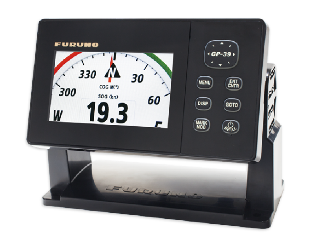
- Sensor, antenna or transducer fouling, damage or misalignment causes unstable, missing or inaccurate data
- Power-supply or processor faults cause resets, blank displays or complete loss of indication
- Cable, connector or network faults cause intermittent data or loss of outputs to dependent bridge systems
- Incorrect configuration or calibration causes persistent disagreement with independent references
- Display, storage or software faults cause frozen values, alarms or unavailable navigation functions
- Small footprint and low power consumption – easy to install in limited bridge space
- WAAS support gives sub‑meter accuracy without extra hardware
- Simple, intuitive menu system suitable for crews with minimal training
- Robust core electronics; proven reliability in coastal operations
- 4.2‑inch display can be hard to read in bright sunlight
- Waypoint memory limited compared with higher‑end units
- Antenna cable design prone to water ingress if not sealed properly
- No multi‑constellation (GLONASS, BeiDou) support – GPS‑only
- Not SOLAS‑approved; unsuitable for vessels that must meet Class A bridge requirements

- Sensor, antenna or transducer fouling, damage or misalignment causes unstable, missing or inaccurate data
- Power-supply or processor faults cause resets, blank displays or complete loss of indication
- Cable, connector or network faults cause intermittent data or loss of outputs to dependent bridge systems
- Incorrect configuration or calibration causes persistent disagreement with independent references
- Display, storage or software faults cause frozen values, alarms or unavailable navigation functions
- Heading accuracy of 0.25° under normal conditions
- Redundant four‑antenna configuration improves reliability and baseline stability
- Direct integration with Furuno bridge consoles eliminates need for a separate magnetic compass
- Supports both GPS and GLONASS constellations, enhancing satellite availability
- Provides continuous heading data even during magnetic disturbances
- Antenna spacing calibration can drift over time, requiring periodic verification
- Heading accuracy degrades at high latitudes where satellite geometry is poorer
- Mounting brackets are prone to corrosion in harsh marine environments; stainless steel upgrades may be needed
- Requires installation of four external antennas and adequate deck space
- Firmware updates may be required to maintain compatibility with newer GNSS signals
- Sensor, antenna or transducer fouling, damage or misalignment causes unstable, missing or inaccurate data
- Power-supply or processor faults cause resets, blank displays or complete loss of indication
- Cable, connector or network faults cause intermittent data or loss of outputs to dependent bridge systems
- Incorrect configuration or calibration causes persistent disagreement with independent references
- Display, storage or software faults cause frozen values, alarms or unavailable navigation functions
- Simple plug‑and‑play installation with built‑in antenna connector
- Low power consumption suitable for vessels with limited electrical capacity
- Clear LCD readout (when contrast is functional) for single‑hand operation
- Cost‑effective solution compared to newer multi‑constellation units
- Provides standard NMEA 0183 output for easy integration with existing bridge systems
- Limited to GPS/DGPS only – no GLONASS, BeiDou or Galileo support
- Older LCD may suffer contrast loss over time, requiring screen replacement
- Antenna low‑noise amplifier (LNA) known to fail after extended service life
- No NMEA 2000 interface; integration with modern digital networks is restricted
- Update rate typically limited to 1 Hz, insufficient for high‑speed maneuvering
- Sensor, antenna or transducer fouling, damage or misalignment causes unstable, missing or inaccurate data
- Power-supply or processor faults cause resets, blank displays or complete loss of indication
- Cable, connector or network faults cause intermittent data or loss of outputs to dependent bridge systems
- Incorrect configuration or calibration causes persistent disagreement with independent references
- Display, storage or software faults cause frozen values, alarms or unavailable navigation functions
- Dual‑constellation (GPS/GLONASS) improves satellite availability and positioning reliability.
- Three‑antenna layout provides built‑in heading data without a separate gyro sensor.
- Compact size and low power consumption suit small to medium vessels and workboats.
- More affordable than the four‑antenna SC‑110 while still meeting basic bridge requirements.
- Standard NMEA 0183 output integrates easily with existing navigation displays.
- Heading accuracy (0.5°) is lower than higher‑end four‑antenna models, limiting precision applications.
- Antenna mounting alignment is critical; misalignment can cause heading errors.
- Reported firmware bugs may require periodic updates to maintain stability.
- Only three antennas provide limited redundancy in harsh sea states or when an antenna fails.
- Not intended for high‑precision dynamic positioning or large vessel bridge systems.
JRC
3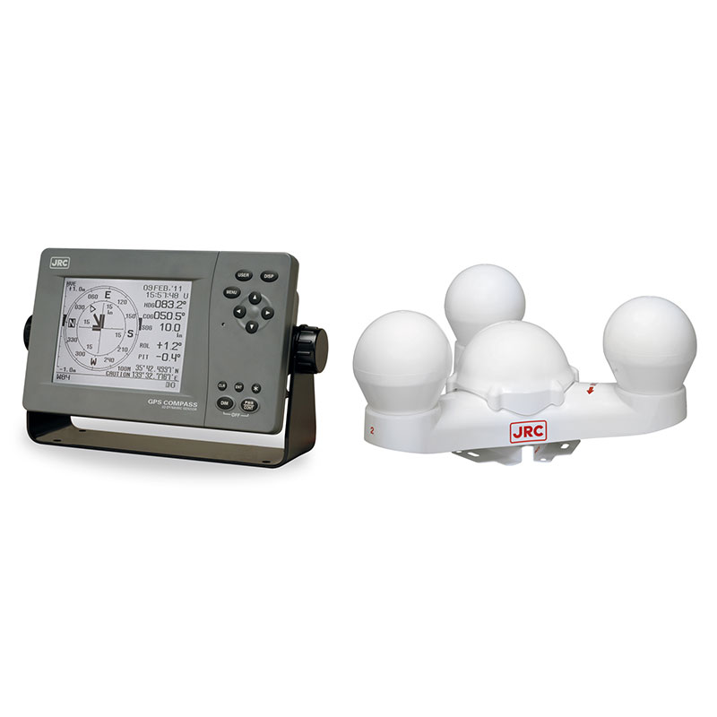
- Sensor, antenna or transducer fouling, damage or misalignment causes unstable, missing or inaccurate data
- Power-supply or processor faults cause resets, blank displays or complete loss of indication
- Cable, connector or network faults cause intermittent data or loss of outputs to dependent bridge systems
- Incorrect configuration or calibration causes persistent disagreement with independent references
- Display, storage or software faults cause frozen values, alarms or unavailable navigation functions
- High heading accuracy (≤0.5°) with dual‑antenna redundancy
- Supports both GPS and GLONASS constellations for better satellite availability
- Compact bridge‑mount design, easy integration with standard autopilot/DPS systems
- Low power consumption compared with inertial‑gyro based compasses
- Requires a minimum antenna separation of about 1 m; short baselines degrade accuracy
- Sensitive to multipath reflections from superstructure or nearby metal objects
- Reported firmware bugs that may need periodic updates or vendor support
- No built‑in inertial sensor, so heading can be lost during GNSS outages
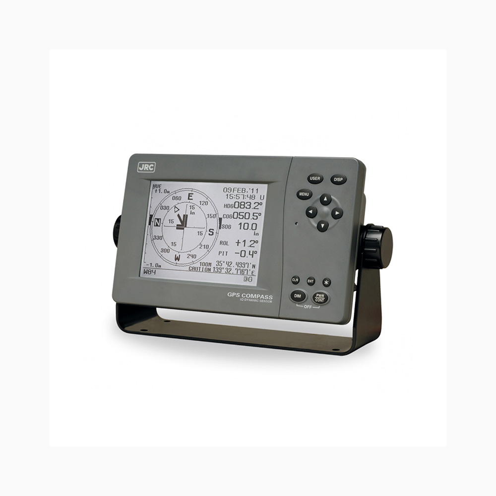
- Sensor, antenna or transducer fouling, damage or misalignment causes unstable, missing or inaccurate data
- Power-supply or processor faults cause resets, blank displays or complete loss of indication
- Cable, connector or network faults cause intermittent data or loss of outputs to dependent bridge systems
- Incorrect configuration or calibration causes persistent disagreement with independent references
- Display, storage or software faults cause frozen values, alarms or unavailable navigation functions
- Dual‑constellation (GPS + GLONASS) improves satellite availability in high‑latitude regions
- IMO SOLAS approval allows direct installation on bridge consoles without additional certification steps
- Standard NMEA 0183 output integrates easily with ECDIS, autopilot and other bridge systems
- Compact unit designed for retrofit into existing bridge panels
- Field reports of antenna connector corrosion leading to intermittent loss of signal
- Occasional position jumps observed when the receiver switches between GPS and GLONASS constellations
- Display back‑light contrast can be insufficient in bright daylight conditions
- Limited to GPS/GLONASS only – no support for newer constellations such as Galileo or BeiDou

- Sensor, antenna or transducer fouling, damage or misalignment causes unstable, missing or inaccurate data
- Power-supply or processor faults cause resets, blank displays or complete loss of indication
- Cable, connector or network faults cause intermittent data or loss of outputs to dependent bridge systems
- Incorrect configuration or calibration causes persistent disagreement with independent references
- Display, storage or software faults cause frozen values, alarms or unavailable navigation functions
- Integrated DGPS beacon receiver for enhanced coastal accuracy
- IMO type‑approval ensures compliance with international standards
- Compact bridge console design simplifies installation
- Supports standard NMEA output formats for easy integration
- Reported occasional loss of DGPS beacon reception in weak signal areas
- Antenna cable aging can lead to intermittent positioning errors
- Limited multi‑constellation support compared with newer GNSS units
- Position output format issues reported on some legacy bridge systems
Kongsberg Maritime
2
- Sensor, antenna or transducer fouling, damage or misalignment causes unstable, missing or inaccurate data
- Power-supply or processor faults cause resets, blank displays or complete loss of indication
- Cable, connector or network faults cause intermittent data or loss of outputs to dependent bridge systems
- Incorrect configuration or calibration causes persistent disagreement with independent references
- Display, storage or software faults cause frozen values, alarms or unavailable navigation functions
- 0.01° roll/pitch accuracy suitable for DP class operations
- Compact design with integrated GNSS multi‑constellation support
- Seamless integration with Kongsberg bridge and DP control systems via standard interfaces (NMEA 2000, IEC 61162)
- Class‑approved hardware that meets stringent offshore certification requirements
- Calibration drift over time requiring periodic recalibration
- High sensitivity to excessive vibration; may need additional isolation on very noisy platforms
- Occasional interface protocol incompatibilities with non‑Kongsberg equipment
- Maintenance intensive compared with simpler heading sensors
- Correction signal loss
- Antenna multipath
- Interface with DP system
- Multi‑constellation support (GPS/GLONASS/Galileo) gives robust satellite coverage.
- DP‑grade accuracy with RTK/PPP correction capability for tight positioning loops.
- Native integration with Kongsberg Dynamic Positioning systems via standard interfaces.
- Low latency output suitable for high‑frequency DP control cycles.
- Built‑in health monitoring, alarms and diagnostic reporting.
- Requires an external correction service or base station; loss of corrections reduces accuracy.
- Antenna placement is critical – multipath can degrade performance in cluttered environments.
- Higher acquisition cost compared with basic GNSS receivers.
- Limited interoperability with non‑Kongsberg DP controllers without additional adapters.
- Firmware updates may necessitate system downtime.
Hemisphere
1- Sensor, antenna or transducer fouling, damage or misalignment causes unstable, missing or inaccurate data
- Power-supply or processor faults cause resets, blank displays or complete loss of indication
- Cable, connector or network faults cause intermittent data or loss of outputs to dependent bridge systems
- Incorrect configuration or calibration causes persistent disagreement with independent references
- Display, storage or software faults cause frozen values, alarms or unavailable navigation functions
- Heading accuracy of 0.1°, meeting most DP class requirements
- Supports GPS, GLONASS, Galileo and BeiDou for robust satellite availability
- RTK capable for centimetre‑level positioning when a base station is available
- Integrated attitude solution (roll/pitch) in a single marine‑grade unit
- Compliant with IEC 61162 standards for easy integration into bridge networks
- Full RTK performance depends on an external base station or network service
- Longer initialization time when the vessel is moving dynamically
- Firmware updates require specialist tools and can be time‑consuming
- Higher purchase price compared with basic GNSS receivers
- Dual‑antenna configuration needed for optimal heading, adding installation complexity
Leica Geosystems
1- Sensor, antenna or transducer fouling, damage or misalignment causes unstable, missing or inaccurate data
- Power-supply or processor faults cause resets, blank displays or complete loss of indication
- Cable, connector or network faults cause intermittent data or loss of outputs to dependent bridge systems
- Incorrect configuration or calibration causes persistent disagreement with independent references
- Display, storage or software faults cause frozen values, alarms or unavailable navigation functions
- Centimetre‑level accuracy using GPS, GLONASS, Galileo and BeiDou
- Supports RTK and differential corrections for high‑precision work
- Designed for harsh marine environments (water‑proof, vibration resistant)
- Integrated with Leica’s survey software ecosystem for seamless data handling
- Requires continuous RTK correction service; performance degrades without it
- Higher purchase and maintenance cost compared with basic GNSS units
- Complex installation and configuration, needing trained personnel
- Limited benefit on vessels that only need standard navigation accuracy
NovAtel
1- Sensor, antenna or transducer fouling, damage or misalignment causes unstable, missing or inaccurate data
- Power-supply or processor faults cause resets, blank displays or complete loss of indication
- Cable, connector or network faults cause intermittent data or loss of outputs to dependent bridge systems
- Incorrect configuration or calibration causes persistent disagreement with independent references
- Display, storage or software faults cause frozen values, alarms or unavailable navigation functions
- Provides simultaneous access to four global constellations, improving signal availability and positioning accuracy in challenging maritime environments.
- Compact OEM form factor that fits inside integrated bridge equipment like GNSS compasses, reducing installation space.
- High update rates typical of NovAtel receivers enable smooth real‑time navigation displays and support for advanced functions such as heading overlay.
- Robust firmware architecture with options for RTK/PPK extensions when higher precision is required.
- Reported OEM integration issues with some bridge system manufacturers, requiring additional engineering effort.
- Firmware compatibility can be a pain point; updates may need coordination with the shipbuilder or equipment integrator.
- Performance is highly dependent on proper antenna selection and placement; sub‑optimal antennas degrade accuracy dramatically.
Raytheon Anschütz
1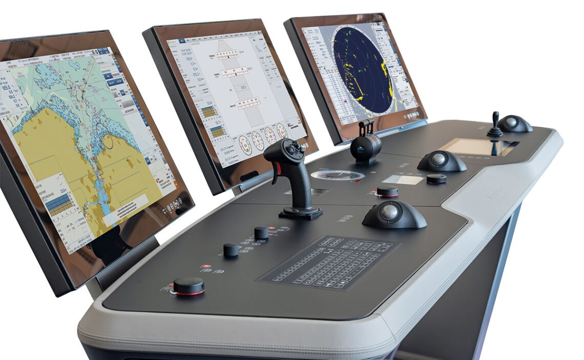
- Sensor, antenna or transducer fouling, damage or misalignment causes unstable, missing or inaccurate data
- Power-supply or processor faults cause resets, blank displays or complete loss of indication
- Cable, connector or network faults cause intermittent data or loss of outputs to dependent bridge systems
- Incorrect configuration or calibration causes persistent disagreement with independent references
- Display, storage or software faults cause frozen values, alarms or unavailable navigation functions
- Supports GPS, GLONASS and Galileo (and optional BeiDou) for improved availability and accuracy
- Designed for seamless integration with the Synapsis bridge system
- IMO approved for use on commercial vessels
- High update rates suitable for dynamic positioning and autopilot functions
- Robust marine‑grade hardware built to withstand harsh sea environments
- Strong dependency on the vessel's integration bus; failures can affect other bridge equipment
- Longer satellite acquisition times in obstructed or poor weather conditions
- Known firmware compatibility issues when upgrading shipboard software
- Higher procurement cost compared with basic single‑constellation receivers
Septentrio
1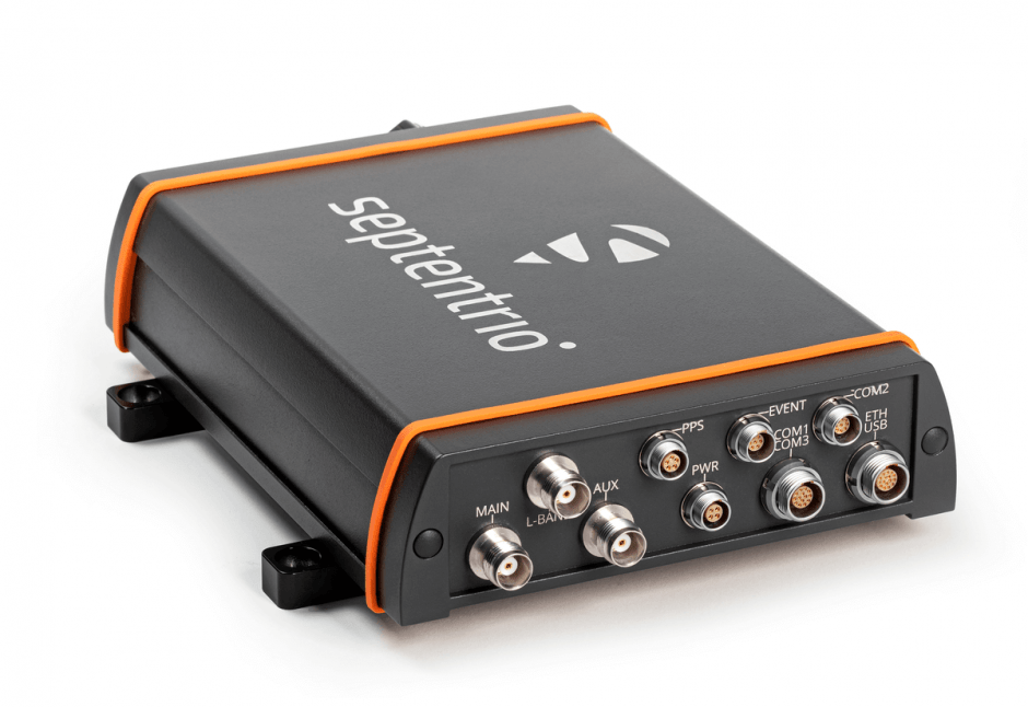
- Sensor, antenna or transducer fouling, damage or misalignment causes unstable, missing or inaccurate data
- Power-supply or processor faults cause resets, blank displays or complete loss of indication
- Cable, connector or network faults cause intermittent data or loss of outputs to dependent bridge systems
- Incorrect configuration or calibration causes persistent disagreement with independent references
- Display, storage or software faults cause frozen values, alarms or unavailable navigation functions
- Centimetre‑level accuracy using RTK/PPP
- Supports GPS, GLONASS, Galileo, BeiDou (and QZSS where available)
- Robust marine‑grade housing and EMI shielding
- Low latency output suitable for DP loops
- Integrated support for NMEA 0183/2000 and RTCM standards
- High susceptibility to RF interference if not properly filtered
- Configuration and tuning can be complex for non‑specialist crews
- Requires external high‑quality antenna and, for RTK, a base station or network service
- Firmware updates are frequent and must be managed carefully
- Higher purchase price compared with basic marine GPS units
Simrad
1- Sensor, antenna or transducer fouling, damage or misalignment causes unstable, missing or inaccurate data
- Power-supply or processor faults cause resets, blank displays or complete loss of indication
- Cable, connector or network faults cause intermittent data or loss of outputs to dependent bridge systems
- Incorrect configuration or calibration causes persistent disagreement with independent references
- Display, storage or software faults cause frozen values, alarms or unavailable navigation functions
- IMO D‑2 approved for reliable differential GPS performance
- Integrated display simplifies installation and reduces cockpit clutter
- Robust marine‑grade housing suitable for harsh environments
- Easy NMEA 0183 output compatibility with existing bridge systems
- Low power consumption, ideal for vessels with limited electrical capacity
- Display readability can be poor in bright sunlight or low light conditions
- Antenna housing has reported susceptibility to water ingress if not properly sealed
- Occasional NMEA output glitches reported by users
- Limited to GPS/DGPS only – no multi‑constellation (GLONASS, Galileo) support
- Older firmware may lack modern interface features such as Bluetooth or Wi‑Fi
Trimble Marine
1- Sensor, antenna or transducer fouling, damage or misalignment causes unstable, missing or inaccurate data
- Power-supply or processor faults cause resets, blank displays or complete loss of indication
- Cable, connector or network faults cause intermittent data or loss of outputs to dependent bridge systems
- Incorrect configuration or calibration causes persistent disagreement with independent references
- Display, storage or software faults cause frozen values, alarms or unavailable navigation functions
- Supports GPS, GLONASS, Galileo and BeiDou for robust satellite availability
- Centimetre‑level accuracy with RTK/VRS corrections
- Marine‑rated hardware designed for harsh bridge environments
- Seamless integration with Trimble’s bridge and DP control systems
- High capital cost compared with standard navigation GNSS units
- Installation and configuration can be complex, requiring specialist support
- Ongoing subscription needed for correction services (e.g., RTX, VRS)
- External antenna placement often required to achieve full performance